These Are The Best Satellite Images Of Earth's Weather Taken So Far
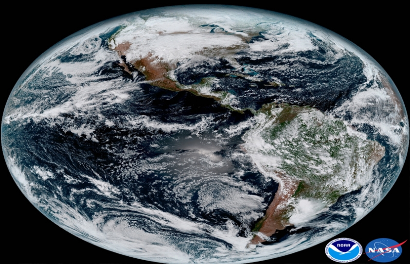
by The Daily Eye Team January 27 2017, 3:12 pm Estimated Reading Time: 0 mins, 25 secsGet ready to revel in some next-level planetary beauty, because on Monday, the National Oceanic and Atmospheric Administration (NOAA) released the first images taken by its GOES-16 weather satellite, launched in November 2016. Perched 22,300 miles above Earth, the spacecraft has a spectacular view of our world’s complex atmospheric dynamics. Take this stunning shot of the Americas, snapped on January 15, which captures the fine details of meteorological phenomena like cloud cover, storm development, and the flow of global air currents.


-173X130.jpg)
-173X130.jpg)
-173X130.jpg)
-173X130.jpg)
_(1)-173X130.jpg)

-173X130.jpg)